Providence, Rhode Island
Appearance
- Wɔatwerɛ nsɛm wei ɛwɔ Asante kasa mu
|
Providence | |||
|---|---|---|---|
| |||

| |||
| Ɔman | United States | ||
| Mpɔtɛm | 53.31 km² | ||
| Nnipa dodoɔ | 190934 ab. (2020) | ||
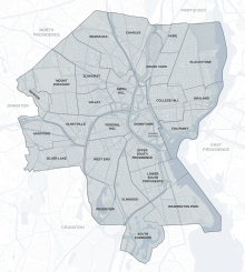
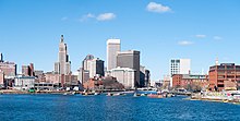
Providence[1][2] yε kuro kεseε a ɛwɔ Rhode Island (USA). Emu nipa dodoɔ yɛ mpem ɔha aduoson nwɔtwe, ne aduanan mmienu (178,042).[3][4]
Nwumakuo ahodoɔ
[sesa]Sɛdeɛ afe mpem mmienu ne du-nan (2014) Comprehensive Annual Financial Report no kyerɛ no,[5] nwumakuo ahodoɔ aduonu a wafa nnipa dodoɔ ama wɔ nwuma retua wɔn ka no na ɛdidi soɔ yi:

| Rank | Employer | Number of employees | Percent of total city employment |
|---|---|---|---|
| 1 | Brown University | 4,600 | 4.30% |
| 2 | Rhode Island Hospital | 4,200 | 3.93% |
| 3 | Lifespan Health System | 1,990 | 1.86% |
| 4 | Women & Infants Hospital | 1,800 | 1.68% |
| 5 | Roger Williams Medical Center | 1,470 | 1.38% |
| 6 | Miriam Hospital | 1,263 | 1.18% |
| 7 | Belo Corp/Providence Journal | 870 | 0.81% |
| 8 | Mars 2000 | 850 | 0.80% |
| 9 | Providence College | 799 | 0.75% |
| 10 | AAA Southern New England | 700 | 0.66% |
| 11 | Johnson & Wales University | 700 | 0.66% |
| 12 | Butler Hospital | 699 | 0.65% |
| 13 | H. Carr & Sons Inc. | 500 | 0.47% |
| 14 | National Grid | 450 | 0.42% |
| 15 | Employment 2000 | 400 | 0.37% |
| 16 | Verizon | 400 | 0.37% |
| 17 | Gilbane Building Co. | 400 | 0.37% |
| 18 | Walmart | 350 | 0.33% |
| 19 | Jewel Case Corp. | 300 | 0.28% |
| 20 | Nordstrom | 300 | 0.28% |
| 21 | Target Corporation | 200 | 0.35% |


Baabi a menyaa mmoa firiiɛ
[sesa]- ↑ https://www.brown.edu/cis/sta/dev/providence_architecture/locations/olneyville/rising_sun_mills/
- ↑ https://archive.org/details/providenceisland00kare/page/17
- ↑ https://www2.census.gov/programs-surveys/popest/datasets/2010-2019/cities/totals/sub-est2019_25.csv
- ↑ https://www2.census.gov/programs-surveys/popest/datasets/2010-2019/cities/totals/sub-est2019_44.csv
- ↑ https://www.providenceri.com/efile/5902


