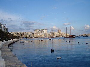
Sliema
Appearance
- Wɔatwerɛ nsɛm wei ɛwɔ Asante kasa mu
Sliema
| part of | Eastern Region (Lvant) |
|---|---|
| official name | Tas-Sliema |
| native label | Tas-Sliema |
| Ɔman | Malta |
| located in the administrative territorial entity | Northern Harbour District, Eastern Region (Lvant) |
| located in time zone | UTC+01:00 |
| coordinate location | 35°54′44″N 14°30′15″E |
| geoshape | Data:Malta/Sliema.map |
| twinned administrative body | Les Sables-d'Olonne, Białystok |
| postal code | SLM |
| wɔn wɛbsaet | http://www.sliema-malta.com/ |
| category for maps | Category:Maps of Sliema |


Sliema yε kuro a ɛwo Mɔlta.

