
File:Turkey relief location map.jpg

Nea wohwɛ yi ne tibea: 800 × 343 pixels. resolutions: 320 × 137 pixels | 640 × 274 pixels | 1,579 × 677 pixels. Foforɔ
Krataa no ankasa (1,579 × 677 pixels, file size: 749 KB, MIME type: image/jpeg)
| Ɛmu nkyerɛkyere mu |
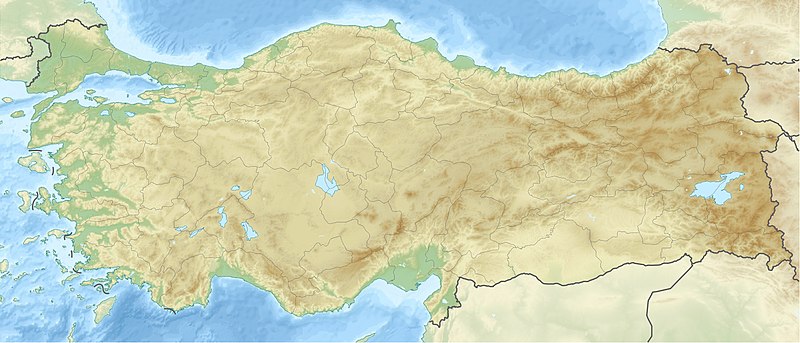
Deutsch: Positionskarte der Türkei Quadratische Plattkarte, N-S-Streckung 120 %. Geographische Begrenzung der Karte: * N: 42.5° N * S: 35.5° N * W: 25.4° O * O: 45.0° O English: Location map of Turkey Equirectangular projection, N/S stretching 120 %. Geographic limits of the map: * N: 42.5° N * S: 35.5° N * W: 25.4° E * E: 45.0° E |
| Da | (UTC) |
| Beaɛ a ɛfiri | |
| Ɔtwerɛfoɔ |
|
| Other versions |
|

| This is a retouched picture, which means that it has been digitally altered from its original version. The original can be viewed here: Turkey location map.svg:
|
I, the copyright holder of this work, hereby publish it under the following licenses:
This file is licensed under the Creative Commons Attribution-Share Alike 3.0 Unported license.
- Wo de woho:
- sɛ wo bɛ kyɛ – to copy, distribute and transmit the work
- to remix – Ma dwumadie no mfa
- Ɛwɔ saa mbra yi ase:
- Nea ɛnam so – Ɛsɛ sɛ wo de nnidi, kyerɛ beaɛ a tumidie krataa no wɔ, na san kyerɛ sɛ nsesae bi aba mu anaa. Ɛsɛ sɛ wo kyerɛ ɛwɔ kwan pa so, na ɛmom ɛnyɛ ɔkwan a ɛkyerɛsɛ nea tumidie krataa no yɛ ne de no agye atum sɛ fa yɛ adwuma.
- share alike – If you remix, transform, or build upon the material, you must distribute your contributions under the same or compatible license as the original.

|
Permission is granted to copy, distribute and/or modify this document under the terms of the GNU Free Documentation License, Version 1.2 or any later version published by the Free Software Foundation; with no Invariant Sections, no Front-Cover Texts, and no Back-Cover Texts. A copy of the license is included in the section entitled GNU Free Documentation License. |
Wobɛtumi ayi tumidie krataa a wopɛ
Original upload log
This image is a derivative work of the following images:
- File:Turkey_location_map.svg licensed with Cc-by-sa-3.0, GFDL
- 2008-07-19T19:49:14Z NordNordWest 1579x677 (999148 Bytes) {{Information |Description= {{de|Positionskarte der [[:de:Türkei|Türkei]]}} Quadratische Plattkarte, N-S-Streckung 120 %. Geographische Begrenzung der Karte: * N: 42.5° N * S: 35.5° N * W: 25.4° O * O: 45.0° O {{en|Loca
Uploaded with derivativeFX
| Annotations | This image is annotated: View the annotations at Commons |
Kratafa ne ho abakɔsɛm
Mia ɛda/berɛ no so na hwɛ sɛnea krataa no baeɛ wo saa berɛ nom
| Da/Mmere | Tɔfabɔ | Akwan ahodoɔ | Odwumdini | Adwenkyerɛ | |
|---|---|---|---|---|---|
| nea ɛkɔ so | 12:42, 28 Ayɛwohomumɔ 2010 | | 1,579 × 677 (749 KB) | Uwe Dedering | {{Information |Description={{de|Positionskarte der Türkei}} Quadratische Plattkarte, N-S-Streckung 120 %. Geographische Begrenzung der Karte: * N: 42.5° N * S: 35.5° N * W: 25.4° O * O: 45.0° O {{en|Location map of [[:en:Turkey|Turkey |
Nkrataa a wɔde di dwuma
Nea ɛdidisoɔ yi kratafa dwumadie this file:
Nea wiase nyinaa de yɛ adwuma
Wikis a edidi so yi de di dwuma:
- Yɛ de ayɛ adwuma wɔ als.wikipedia.org
- Yɛ de ayɛ adwuma wɔ am.wikipedia.org
- Yɛ de ayɛ adwuma wɔ ar.wikipedia.org
- قالب:خريطة مواقع تركيا
- فالق شمال الأناضول
- مستخدم:عبد المؤمن/مسودات/خرائط/تركيا
- مستخدم:"Yahia"/ملعب
- نهر مراد
- وحدة:Location map/data/Turkey
- وحدة:Location map/data/Turkey/شرح
- نفق الاستقلال 15 يوليو
- أطلس جت الرحلة 4203
- أولودنيز
- زلزال معمورة العزيز 2020
- قونور ألب
- الاشتباكات الحدودية التركية السورية خلال الحرب الأهلية السورية
- زلزال قهرمان مرعش 2023
- زلزال أرزنجان 1939
- زلزال أضنة وجيحان 1998
- زلزال أميك 1872
- Yɛ de ayɛ adwuma wɔ arz.wikipedia.org
- Yɛ de ayɛ adwuma wɔ ast.wikipedia.org
- Yɛ de ayɛ adwuma wɔ av.wikipedia.org
- Yɛ de ayɛ adwuma wɔ azb.wikipedia.org
- Yɛ de ayɛ adwuma wɔ az.wikipedia.org
View more global usage of this file.