
File:United Kingdom NUTS location map.svg

Size of this PNG preview of this SVG file: 388 × 600 pixels. resolutions: 155 × 240 pixels | 310 × 480 pixels | 497 × 768 pixels | 663 × 1,024 pixels | 1,325 × 2,048 pixels | 886 × 1,369 pixels. Foforɔ
Krataa no ankasa (SVG file, nominally 886 × 1,369 pixels, file size: 873 KB)
| Ɛmu nkyerɛkyere mu |
Deutsch: Positionskarte des Vereinigten Königreichs mit NUTS-1-Gebieten
Quadratische Plattkarte, N-S-Streckung 170 %. Geographische Begrenzung der Karte:
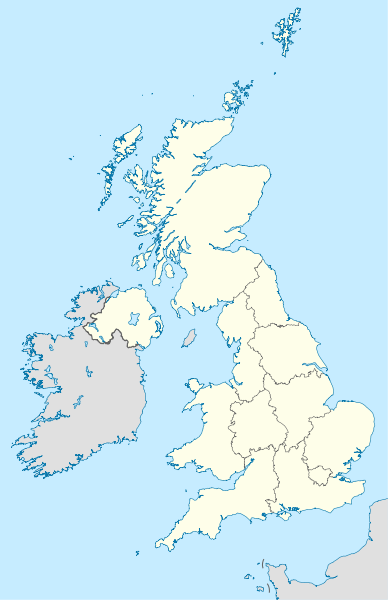
English: Location map of the United Kingdom with NUTS 1 areas
Equirectangular projection, N/S stretching 170 %. Geographic limits of the map:
|
| Da | (UTC) |
| Beaɛ a ɛfiri | |
| Ɔtwerɛfoɔ |
|
| Other versions |
|


This file is licensed under the Creative Commons Attribution-Share Alike 3.0 Unported license.
- Wo de woho:
- sɛ wo bɛ kyɛ – to copy, distribute and transmit the work
- to remix – Ma dwumadie no mfa
- Ɛwɔ saa mbra yi ase:
- Nea ɛnam so – Ɛsɛ sɛ wo de nnidi, kyerɛ beaɛ a tumidie krataa no wɔ, na san kyerɛ sɛ nsesae bi aba mu anaa. Ɛsɛ sɛ wo kyerɛ ɛwɔ kwan pa so, na ɛmom ɛnyɛ ɔkwan a ɛkyerɛsɛ nea tumidie krataa no yɛ ne de no agye atum sɛ fa yɛ adwuma.
- share alike – If you remix, transform, or build upon the material, you must distribute your contributions under the same or compatible license as the original.
Original upload log
This image is a derivative work of the following images:
- File:United_Kingdom_location_map.svg licensed with Cc-by-sa-3.0, GFDL
- 2011-01-11T22:14:29Z NordNordWest 886x1369 (660787 Bytes) upd
- 2008-07-19T21:44:02Z NordNordWest 886x1369 (1484834 Bytes) '
- 2008-07-07T14:29:12Z NordNordWest 886x1369 (1484834 Bytes) '
- 2008-07-01T16:17:52Z NordNordWest 886x1369 (1547699 Bytes) '
- 2008-07-01T16:05:12Z NordNordWest 886x1369 (1546376 Bytes) {{Information |Description= {{de|Positionskarte des [[:de:Vereinigtes Königreich|Vereinigten Königreichs]]}} Quadratische Plattkarte, N-S-Streckung 170 %. Geographische Begrenzung der Karte: * N: 61.0° N * S: 49.0° N * W:
- File:England_location_map.svg licensed with Cc-by-sa-3.0
- 2010-03-12T22:58:19Z Spischot 816x991 (468569 Bytes) {{Information |Description= {{de|Positionskarte von [[:de:England|]]}} Quadratische Plattkarte, N-S-Streckung 170 %. Geographische Begrenzung der Karte: * N: 56.0° N * S: 49.75° N * W: 6.75° W * O: 2.0° O {{en|Location
Uploaded with derivativeFX
Kratafa ne ho abakɔsɛm
Mia ɛda/berɛ no so na hwɛ sɛnea krataa no baeɛ wo saa berɛ nom
| Da/Mmere | Tɔfabɔ | Akwan ahodoɔ | Odwumdini | Adwenkyerɛ | |
|---|---|---|---|---|---|
| nea ɛkɔ so | 14:12, 22 Ɔpɛpɔn 2011 | | 886 × 1,369 (873 KB) | NordNordWest | {{Information |Description={{de|Positionskarte des Vereinigten Königreichs mit NUTS-1-Gebieten}} Quadratische Plattkarte, N-S-Streckung 170 %. Geographische Begrenzung der Karte: * N: 61.0° N * S: 49.0° N * W: 11.0° |
Nkrataa a wɔde di dwuma
Nkratafa biara nni hɔ a ɛde wei yɛ adwuma.
Nea wiase nyinaa de yɛ adwuma
Wikis a edidi so yi de di dwuma:
- Yɛ de ayɛ adwuma wɔ als.wikipedia.org
- Yɛ de ayɛ adwuma wɔ ast.wikipedia.org
- Yɛ de ayɛ adwuma wɔ ce.wikipedia.org
- Yɛ de ayɛ adwuma wɔ ckb.wikipedia.org
- Yɛ de ayɛ adwuma wɔ de.wikipedia.org
- Yɛ de ayɛ adwuma wɔ diq.wikipedia.org
- Yɛ de ayɛ adwuma wɔ en.wikipedia.org
- Yɛ de ayɛ adwuma wɔ es.wikipedia.org
- Yɛ de ayɛ adwuma wɔ frr.wikipedia.org
- Yɛ de ayɛ adwuma wɔ hy.wikipedia.org
- Yɛ de ayɛ adwuma wɔ io.wikipedia.org
- Yɛ de ayɛ adwuma wɔ kaa.wikipedia.org
- Yɛ de ayɛ adwuma wɔ ka.wikipedia.org
- Yɛ de ayɛ adwuma wɔ kbd.wikipedia.org
- Yɛ de ayɛ adwuma wɔ ky.wikipedia.org
- Yɛ de ayɛ adwuma wɔ lez.wikipedia.org
- Yɛ de ayɛ adwuma wɔ mn.wikipedia.org
- Yɛ de ayɛ adwuma wɔ myv.wikipedia.org
- Yɛ de ayɛ adwuma wɔ nap.wikipedia.org
View more global usage of this file.