
File:Serbia (orthographic projection).svg

Size of this PNG preview of this SVG file: 600 × 600 pixels. resolutions: 240 × 240 pixels | 480 × 480 pixels | 768 × 768 pixels | 1,024 × 1,024 pixels | 2,048 × 2,048 pixels. Foforɔ
Krataa no ankasa (SVG file, nominally 2,048 × 2,048 pixels, file size: 1.45 MB)
Tɔ fa
| Ɛmu nkyerɛkyere mu |
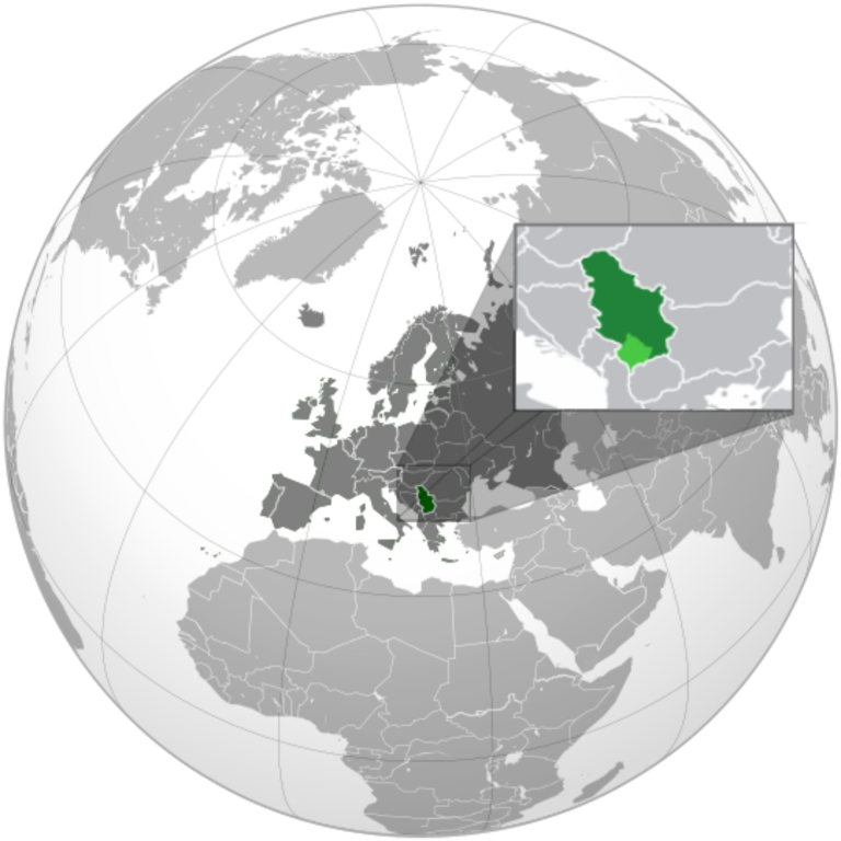
English: Serbia orthographic projection |
||
| Da | |||
| Beaɛ a ɛfiri |
Wo ankasa w'adwuma This vector image includes elements that have been taken or adapted from this file: This vector image includes elements that have been taken or adapted from this file: This vector image includes elements that have been taken or adapted from this file: |
||
| Ɔtwerɛfoɔ | Милан Јелисавчић | ||
| Other versions |
.svg)
|
||
| SVG genesis |
.svg)
.svg)
.svg)
.svg)
.svg)
.svg)
.svg)
.svg)
.svg)
.svg)
.svg)
.svg)
.svg)
.svg)
.svg)
.svg)
.svg)
.svg)
.svg)
.svg)
.svg)
.svg)
.svg)
.svg)
.svg)
.svg)
.svg)
.svg)
.svg)
.svg)
.svg)
.svg)
.svg)
.svg)
.svg)
.svg)
.svg)
.svg)
.svg)
.svg)
.svg)
.svg)
.svg)
.svg)
.svg)
.svg)
.svg)
.svg)
.svg)
.svg)
.svg)
.svg)
.svg)
.svg)
.svg)
.svg)
.svg)
.svg)
.svg)
.svg)
.svg)
.svg)
.svg)
.svg)
.svg)
.svg)
.svg)
.svg)
.svg)
.svg)
.svg)
.svg)
.svg)

.svg)

.svg)

.svg)
.svg)
.svg)
.svg)
.svg)
.svg)
.svg)


.svg)
.svg)
.svg)
.svg)
.svg)
.svg)
.svg)

.svg)
.svg)
.svg)
.svg)
.svg)
.svg)
.svg)
.svg)
.svg)

.svg)
.svg)
.svg)
.svg)
.svg)
.svg)
.svg)
_without_national_boundaries.svg)
.svg)
.svg)
.svg)
.svg)
.svg)
.svg)

.svg)
.svg)
.png)
.svg)
.svg)
.svg)
.svg)

.svg)
.svg)
.svg)
.svg)
.svg)
.svg)
.svg)
.svg)
.svg)
.svg)
.svg)

.svg)
.svg)
.svg)
.svg)
.svg)
.svg)
.svg)
.svg)
.svg)

.svg)
.svg)

.svg)
.svg)
.svg)
.svg)
.svg)
.svg)
.svg)
.svg)
.svg)
.svg)
.svg)
.svg)
.svg)
.svg)
.svg)
.svg)
.svg)
.svg)
.svg)
.svg)
.svg)
.svg)
.svg)
.svg)
.svg)
.svg)
.svg)
_-_Crimea_disputed.svg)
.svg)
.svg)
.svg)
.svg)
.svg)
.svg)
.svg)
.svg)
.svg)
.svg)
.svg)
_political.svg)
.svg)
.svg)
.svg)
.svg)
_-_Crimea_disputed_-_no_borders.svg)
.svg)
.svg)
.svg)
.svg)
.svg)
.svg)
.svg)
.svg)
.svg)
.svg)
.svg)

.svg)
.svg)
.svg)

.png)
.svg)
.svg)
.svg)
.svg)
.svg)
.svg)
.svg)
.svg)
.svg)
.svg)
.svg)
.svg)
.svg)
.svg)
.svg)
.svg)
.svg)
.svg)
.svg)
.svg)
.svg)
.svg)
.svg)
.svg)
.svg)
.svg)
.svg)
.svg)
.svg)
.svg)
.svg)
.svg)
.svg)
.svg)
.png)
.svg)
.svg)
.svg)
_(orthographic_projection).png)

.svg)
.svg)
.svg)
Tumidie krataa
I, the copyright holder of this work, hereby publish it under the following license:
This file is licensed under the Creative Commons Attribution-Share Alike 3.0 Unported license.
- Wo de woho:
- sɛ wo bɛ kyɛ – to copy, distribute and transmit the work
- to remix – Ma dwumadie no mfa
- Ɛwɔ saa mbra yi ase:
- Nea ɛnam so – Ɛsɛ sɛ wo de nnidi, kyerɛ beaɛ a tumidie krataa no wɔ, na san kyerɛ sɛ nsesae bi aba mu anaa. Ɛsɛ sɛ wo kyerɛ ɛwɔ kwan pa so, na ɛmom ɛnyɛ ɔkwan a ɛkyerɛsɛ nea tumidie krataa no yɛ ne de no agye atum sɛ fa yɛ adwuma.
- share alike – If you remix, transform, or build upon the material, you must distribute your contributions under the same or compatible license as the original.
Kratafa ne ho abakɔsɛm
Mia ɛda/berɛ no so na hwɛ sɛnea krataa no baeɛ wo saa berɛ nom
.svg&dir=prev)
.svg&offset=20120121141735)
.svg&offset=&limit=20)
.svg&offset=&limit=50)
.svg&offset=&limit=100)
.svg&offset=&limit=250)
.svg&offset=&limit=500)
| Da/Mmere | Tɔfabɔ | Akwan ahodoɔ | Odwumdini | Adwenkyerɛ | |
|---|---|---|---|---|---|
| nea ɛkɔ so | 18:34, 27 Ɔpɛnimma 2022 | | 2,048 × 2,048 (1.45 MB) | Iktsokh | More correct visualization of the dividing line on the territory of the Caucasus Range |
| 06:47, 24 Ogyefuo 2022 |  | 541 × 541 (205 KB) | Ahmet Q. | Reverted to version as of 18:50, 15 December 2021 (UTC) Rv POV-pushing | |
| 18:32, 26 Ɔpɛnimma 2021 |  | 541 × 541 (338 KB) | Vacant0 | Reverted to version as of 18:33, 4 June 2021 (UTC) | |
| 18:50, 15 Ɔpɛnimma 2021 |  | 541 × 541 (205 KB) | موسى | Reverted to version as of 23:32, 30 June 2020 (UTC) - саботаж; зеленый цвет в Африке | |
| 18:33, 4 Ayɛwohomumɔ 2021 |  | 541 × 541 (338 KB) | Vacant0 | Reverted to version as of 15:49, 29 December 2019 (UTC) | |
| 23:32, 30 Ayɛwohomumɔ 2020 |  | 541 × 541 (205 KB) | Yeetstuff | Fixed inaccuracies (EU as whole country, French Guiana colored in, Eritrea and South Sudan not shown, Yemen split) | |
| 15:49, 29 Ɔpɛnimma 2019 |  | 541 × 541 (338 KB) | Goran tek-en | Added border for South Sudan as requested by Maphobbyist | |
| 00:37, 22 Ɔpɛpɔn 2012 |  | 541 × 541 (654 KB) | Zenfiric | minor corrections | |
| 14:44, 21 Ɔpɛpɔn 2012 |  | 541 × 541 (651 KB) | Zenfiric | minor correction | |
| 14:17, 21 Ɔpɛpɔn 2012 |  | 541 × 541 (651 KB) | Zenfiric | Projection with inset |
Nkrataa a wɔde di dwuma
Nea ɛdidisoɔ yi kratafa dwumadie this file:
Nea wiase nyinaa de yɛ adwuma
Wikis a edidi so yi de di dwuma:
- Yɛ de ayɛ adwuma wɔ af.wikipedia.org
- Yɛ de ayɛ adwuma wɔ arc.wikipedia.org
- Yɛ de ayɛ adwuma wɔ ar.wikipedia.org
- العلاقات العراقية الصربية
- العلاقات الأمريكية الصربية
- العلاقات الأنغولية الصربية
- العلاقات الصربية الكورية الجنوبية
- العلاقات الإريترية الصربية
- العلاقات السويسرية الصربية
- العلاقات الألمانية الصربية
- العلاقات الصربية الليختنشتانية
- العلاقات البوليفية الصربية
- العلاقات الصربية الموزمبيقية
- العلاقات الألبانية الصربية
- العلاقات البلجيكية الصربية
- العلاقات الإثيوبية الصربية
- العلاقات البيلاروسية الصربية
- العلاقات الصربية الطاجيكستانية
- العلاقات الروسية الصربية
- العلاقات الرومانية الصربية
- العلاقات الأرجنتينية الصربية
- العلاقات الصربية الغامبية
- العلاقات الصربية القبرصية
- العلاقات السيراليونية الصربية
- العلاقات الصربية النيبالية
- العلاقات الصربية الليبيرية
- العلاقات التشيكية الصربية
- العلاقات الصربية الميانمارية
- العلاقات الصربية الكندية
- العلاقات السعودية الصربية
- العلاقات الزيمبابوية الصربية
- العلاقات الإسرائيلية الصربية
- العلاقات البالاوية الصربية
- العلاقات الصربية المالية
- العلاقات الصربية النيجيرية
- العلاقات اليمنية الصربية
- العلاقات الصربية الفانواتية
- العلاقات الغابونية الصربية
- العلاقات البنمية الصربية
- العلاقات الصربية الكوبية
- العلاقات الجورجية الصربية
- العلاقات التونسية الصربية
- العلاقات الصربية الكورية الشمالية
- العلاقات الهندية الصربية
- العلاقات اليابانية الصربية
- العلاقات الإيطالية الصربية
- العلاقات الصربية الناوروية
- العلاقات الأسترالية الصربية
- العلاقات الزامبية الصربية
- العلاقات الصربية الفيجية
- العلاقات المارشالية الصربية
View more global usage of this file.
.svg)
.svg)