
File:Most beautiful villages of the world montsoreau 2.jpg
Nea wohwɛ yi ne tibea: 800 × 600 pixels. resolutions: 320 × 240 pixels | 640 × 480 pixels | 1,024 × 768 pixels | 1,280 × 960 pixels | 2,560 × 1,920 pixels | 4,608 × 3,456 pixels. Foforɔ
Krataa no ankasa (4,608 × 3,456 pixels, file size: 7.99 MB, MIME type: image/jpeg)
|
This place is a UNESCO World Heritage Site, listed as
The Loire Valley between Sully-sur-Loire and Chalonnes.
|
Tɔ fa
| Ɛmu nkyerɛkyere mu |
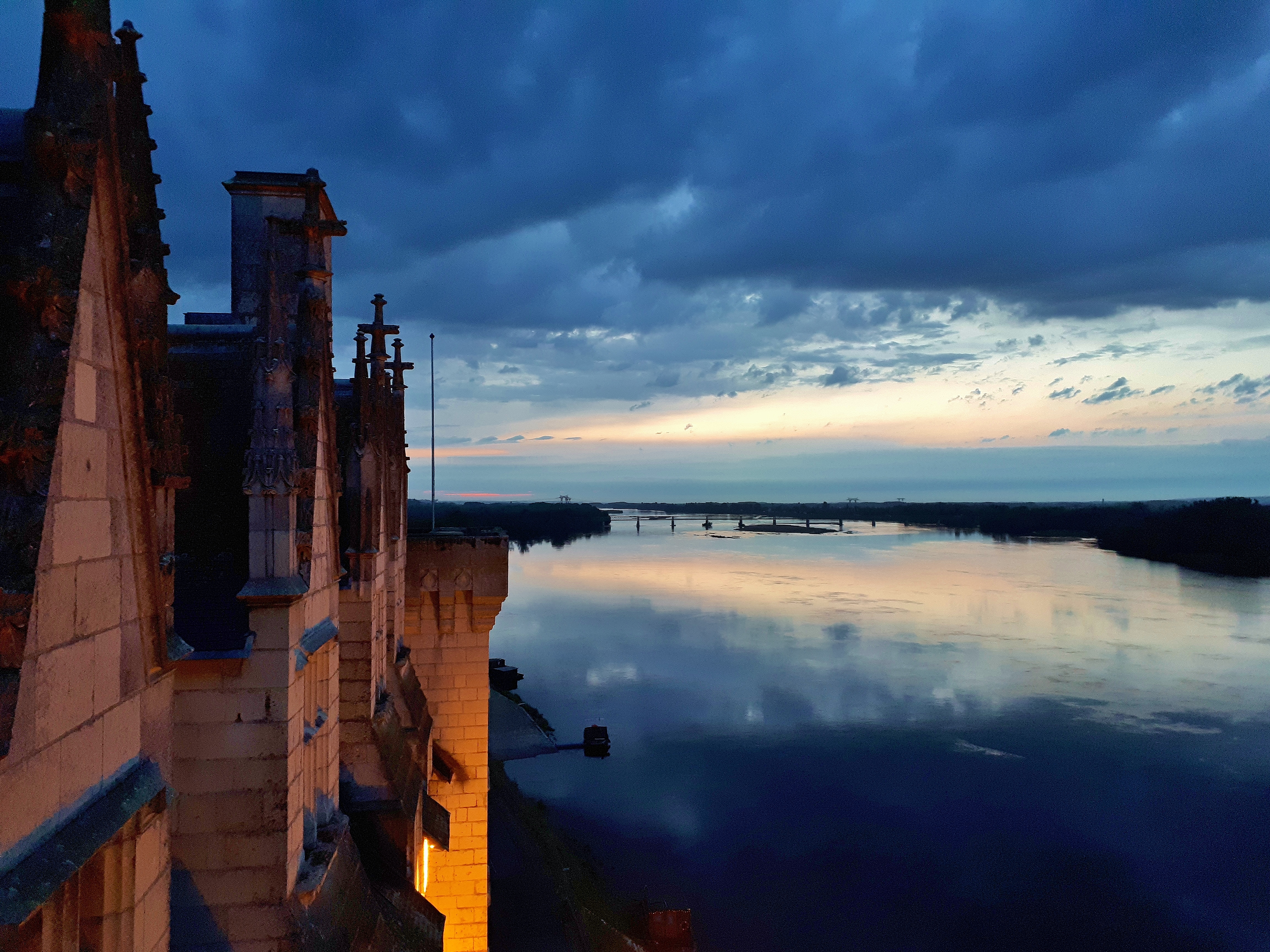
English: The Loire, view from the Château de Montsoreau-Museum of Contemporary Art in the Loire Valley. Monstoreau is listed one of the most beautiful villages of France, member of the most beautiful villages of the world.
|
|||
| Da | ||||
| Beaɛ a ɛfiri | Wo ankasa w'adwuma | |||
| Ɔtwerɛfoɔ | Philippe49730 |
| Camera location | | View this and other nearby images on: OpenStreetMap |
|---|
Tumidie krataa
I, the copyright holder of this work, hereby publish it under the following license:
This file is licensed under the Creative Commons Attribution-Share Alike 4.0 International license.
- Wo de woho:
- sɛ wo bɛ kyɛ – to copy, distribute and transmit the work
- to remix – Ma dwumadie no mfa
- Ɛwɔ saa mbra yi ase:
- Nea ɛnam so – Ɛsɛ sɛ wo de nnidi, kyerɛ beaɛ a tumidie krataa no wɔ, na san kyerɛ sɛ nsesae bi aba mu anaa. Ɛsɛ sɛ wo kyerɛ ɛwɔ kwan pa so, na ɛmom ɛnyɛ ɔkwan a ɛkyerɛsɛ nea tumidie krataa no yɛ ne de no agye atum sɛ fa yɛ adwuma.
- share alike – If you remix, transform, or build upon the material, you must distribute your contributions under the same or compatible license as the original.
Kratafa ne ho abakɔsɛm
Mia ɛda/berɛ no so na hwɛ sɛnea krataa no baeɛ wo saa berɛ nom
| Da/Mmere | Tɔfabɔ | Akwan ahodoɔ | Odwumdini | Adwenkyerɛ | |
|---|---|---|---|---|---|
| nea ɛkɔ so | 15:48, 31 Kotonimma 2018 | | 4,608 × 3,456 (7.99 MB) | Philippe49730 | User created page with UploadWizard |
Nkrataa a wɔde di dwuma
Nea ɛdidisoɔ yi kratafa dwumadie this file:
Nea wiase nyinaa de yɛ adwuma
Wikis a edidi so yi de di dwuma:
- Yɛ de ayɛ adwuma wɔ af.wikipedia.org
- Yɛ de ayɛ adwuma wɔ ar.wikipedia.org
- Yɛ de ayɛ adwuma wɔ ast.wikipedia.org
- Yɛ de ayɛ adwuma wɔ be.wikipedia.org
- Yɛ de ayɛ adwuma wɔ bg.wikipedia.org
- Yɛ de ayɛ adwuma wɔ bn.wikipedia.org
- Yɛ de ayɛ adwuma wɔ ca.wikipedia.org
- Yɛ de ayɛ adwuma wɔ ceb.wikipedia.org
- Yɛ de ayɛ adwuma wɔ cs.wikipedia.org
- Yɛ de ayɛ adwuma wɔ da.wikipedia.org
- Yɛ de ayɛ adwuma wɔ de.wikipedia.org
- Yɛ de ayɛ adwuma wɔ el.wikipedia.org
- Yɛ de ayɛ adwuma wɔ en.wikipedia.org
- Yɛ de ayɛ adwuma wɔ en.wikivoyage.org
- Yɛ de ayɛ adwuma wɔ es.wikipedia.org
- Yɛ de ayɛ adwuma wɔ et.wikipedia.org
- Yɛ de ayɛ adwuma wɔ eu.wikipedia.org
- Yɛ de ayɛ adwuma wɔ fa.wikipedia.org
- Yɛ de ayɛ adwuma wɔ fi.wikipedia.org
- Yɛ de ayɛ adwuma wɔ frp.wikipedia.org
- Yɛ de ayɛ adwuma wɔ fr.wikipedia.org
- Yɛ de ayɛ adwuma wɔ ga.wikipedia.org
- Yɛ de ayɛ adwuma wɔ gl.wikipedia.org
- Yɛ de ayɛ adwuma wɔ ha.wikipedia.org
- Yɛ de ayɛ adwuma wɔ haw.wikipedia.org
- Yɛ de ayɛ adwuma wɔ he.wikipedia.org
- Yɛ de ayɛ adwuma wɔ hif.wikipedia.org
- Yɛ de ayɛ adwuma wɔ hi.wikipedia.org
- Yɛ de ayɛ adwuma wɔ hr.wikipedia.org
- Yɛ de ayɛ adwuma wɔ hy.wikipedia.org
- Yɛ de ayɛ adwuma wɔ id.wikipedia.org
- Yɛ de ayɛ adwuma wɔ is.wikipedia.org
- Yɛ de ayɛ adwuma wɔ it.wikipedia.org
- Yɛ de ayɛ adwuma wɔ it.wikivoyage.org
- Yɛ de ayɛ adwuma wɔ ja.wikipedia.org
- Yɛ de ayɛ adwuma wɔ jv.wikipedia.org
- Yɛ de ayɛ adwuma wɔ kab.wikipedia.org
- Yɛ de ayɛ adwuma wɔ ko.wikipedia.org
- Yɛ de ayɛ adwuma wɔ ku.wikipedia.org
View more global usage of this file.