
File:Mid-ocean ridge system.gif

Nea wohwɛ yi ne tibea: 800 × 487 pixels. resolutions: 320 × 195 pixels | 640 × 389 pixels | 1,152 × 701 pixels. Foforɔ
Krataa no ankasa (1,152 × 701 pixels, file size: 500 KB, MIME type: image/gif)
Tɔ fa
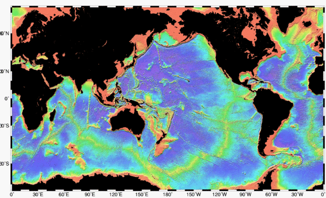
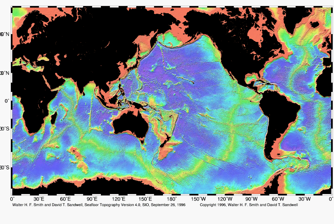
| Ɛmu nkyerɛkyere mu | Map of the mid-ocean ridge system (yellow-green) in the Earth’s oceans. |
| Da | |
| Beaɛ a ɛfiri | http://www.ngdc.noaa.gov/mgg/image/global_topo_large.gif |
| Ɔtwerɛfoɔ | National Oceanic and Atmospheric Administration |
Tumidie krataa
This image is in the public domain because it contains materials that originally came from the U.S. National Oceanic and Atmospheric Administration, taken or made as part of an employee's official duties.
|
Kratafa ne ho abakɔsɛm
Mia ɛda/berɛ no so na hwɛ sɛnea krataa no baeɛ wo saa berɛ nom
| Da/Mmere | Tɔfabɔ | Akwan ahodoɔ | Odwumdini | Adwenkyerɛ | |
|---|---|---|---|---|---|
| nea ɛkɔ so | 02:48, 1 Kotonimma 2010 | | 1,152 × 701 (500 KB) | Adrignola | {{Information |Description=Map of the mid-ocean ridge system (yellow-green) in the Earth’s oceans. |Source=http://www.ngdc.noaa.gov/mgg/image/global_topo_large.gif |Date=1996-09-26 |Author=w:National Oceanic and Atmospheric Administration |Permissi |
Nkrataa a wɔde di dwuma
Nea ɛdidisoɔ yi kratafa dwumadie this file:
Nea wiase nyinaa de yɛ adwuma
Wikis a edidi so yi de di dwuma:
- Yɛ de ayɛ adwuma wɔ ban.wikipedia.org
- Yɛ de ayɛ adwuma wɔ en.wikipedia.org
- Yɛ de ayɛ adwuma wɔ en.wikibooks.org
- Yɛ de ayɛ adwuma wɔ en.wiktionary.org
- Yɛ de ayɛ adwuma wɔ es.wikibooks.org
- Yɛ de ayɛ adwuma wɔ hy.wikipedia.org
- Yɛ de ayɛ adwuma wɔ id.wikipedia.org
- Yɛ de ayɛ adwuma wɔ ko.wikipedia.org
- Yɛ de ayɛ adwuma wɔ ru.wikipedia.org