
File:CAN orthographic.svg

Size of this PNG preview of this SVG file: 551 × 551 pixels. resolutions: 240 × 240 pixels | 480 × 480 pixels | 768 × 768 pixels | 1,024 × 1,024 pixels | 2,048 × 2,048 pixels. Foforɔ
Krataa no ankasa (SVG file, nominally 551 × 551 pixels, file size: 1.83 MB)
Tɔ fa
| Ɛmu nkyerɛkyere mu |
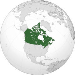
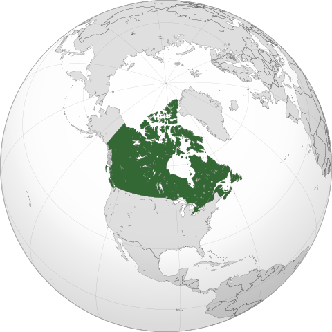
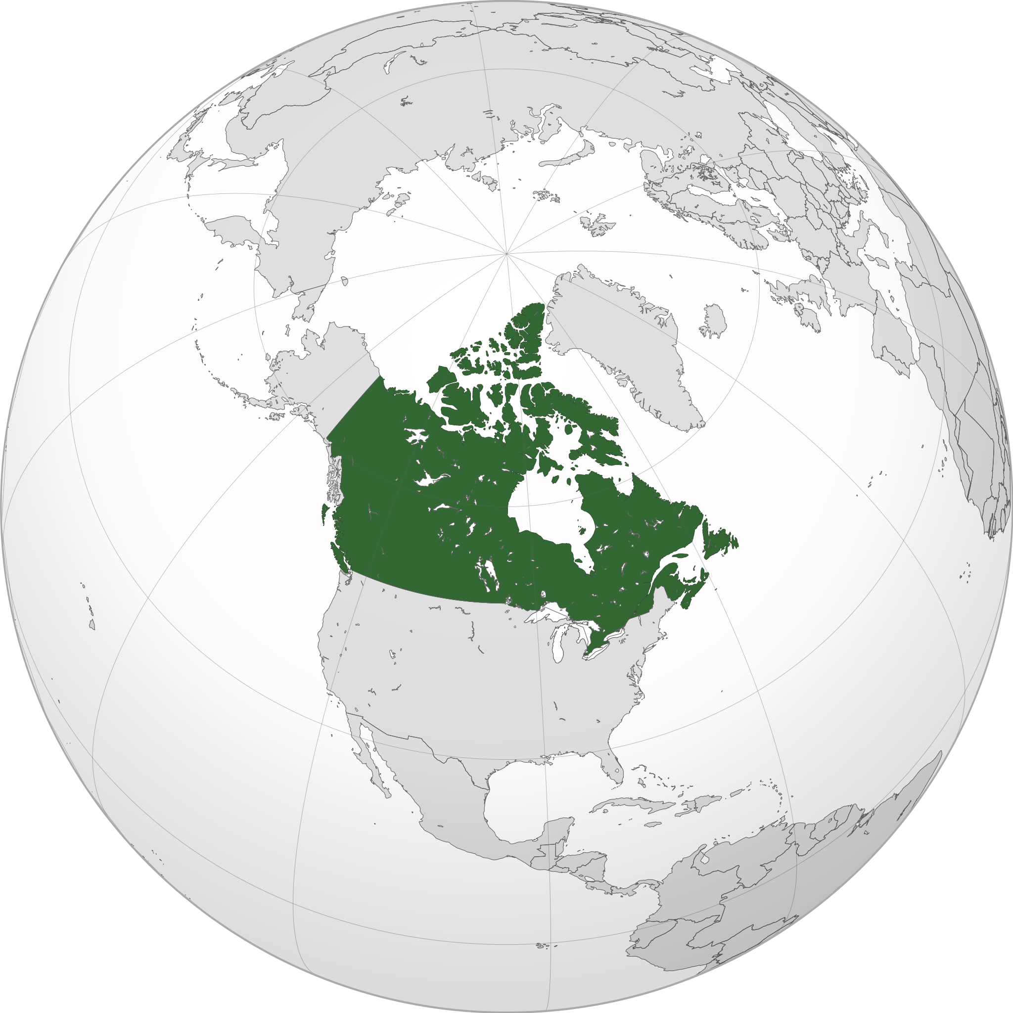
English: A map of the hemisphere centred on -95, 60, using an orthographic projection, created using gringer's Perl script with Natural Earth Data (1:50000 resolution, simplified to 0.25px). Canada is highlighted in green.
Official territory. Claimed territories. |
| Da | |
| Beaɛ a ɛfiri | Wo ankasa w'adwuma with Natural Earth Data |
| Ɔtwerɛfoɔ | Addicted04 |
| SVG genesis |
.svg)
.svg)
.svg)
.svg)
.svg)
.svg)
.svg)
.svg)
.svg)
.svg)
.svg)
.svg)
.svg)
.svg)
.svg)
.svg)
.svg)
.svg)
.svg)
.svg)
.svg)
.svg)
.svg)
.svg)
.svg)
.svg)
.svg)
.svg)
.svg)
.svg)
.svg)
.svg)
.svg)
.svg)
.svg)
.svg)
.svg)
.svg)
.svg)
.svg)
.svg)
.svg)
.svg)
.svg)
.svg)
.svg)
.svg)
.svg)
.svg)
.svg)
.svg)
.svg)
.svg)
.svg)
.svg)
.svg)
.svg)
.svg)
.svg)
.svg)
.svg)
.svg)
.svg)
.svg)
.svg)
.svg)
.svg)
.svg)
.svg)
.svg)
.svg)
.svg)
.svg)
.svg)

.svg)

.svg)

.svg)
.svg)
.svg)
.svg)
.svg)
.svg)
.svg)


.svg)
.svg)
.svg)
.svg)
.svg)
.svg)
.svg)

.svg)
.svg)
.svg)
.svg)
.svg)
.svg)
.svg)
.svg)
.svg)

.svg)
.svg)
.svg)
.svg)
.svg)
.svg)
.svg)
_without_national_boundaries.svg)
.svg)
.svg)
.svg)
.svg)
.svg)
.svg)

.svg)
.svg)
.png)
.svg)
.svg)
.svg)
.svg)

.svg)
.svg)
.svg)
.svg)
.svg)
.svg)
.svg)
.svg)
.svg)
.svg)
.svg)

.svg)
.svg)
.svg)
.svg)
.svg)
.svg)
.svg)
.svg)
.svg)

.svg)
.svg)

.svg)
.svg)
.svg)
.svg)
.svg)
.svg)
.svg)
.svg)
.svg)
.svg)
.svg)
.svg)
.svg)
.svg)
.svg)
.svg)
.svg)
.svg)
.svg)
.svg)
.svg)
.svg)
.svg)
.svg)
.svg)
.svg)
.svg)
_-_Crimea_disputed.svg)
.svg)
.svg)
.svg)
.svg)
.svg)
.svg)
.svg)
.svg)
.svg)
.svg)
.svg)
_political.svg)
.svg)
.svg)
.svg)
.svg)
_-_Crimea_disputed_-_no_borders.svg)
.svg)
.svg)
.svg)
.svg)
.svg)
.svg)
.svg)
.svg)
.svg)
.svg)
.svg)

.svg)
.svg)
.svg)

.png)
.svg)
.svg)
.svg)
.svg)
.svg)
.svg)
.svg)
.svg)
.svg)
.svg)
.svg)
.svg)
.svg)
.svg)
.svg)
.svg)
.svg)
.svg)
.svg)
.svg)
.svg)
.svg)
.svg)
.svg)
.svg)
.svg)
.svg)
.svg)
.svg)
.svg)
.svg)
.svg)
.svg)
.svg)
.png)
.svg)
.svg)
.svg)
_(orthographic_projection).png)
| Orthographic projections maps created by Ssolbergj |
|---|
| Orthographic projections maps created by Ssolbergj: |
.svg)
.svg)
Tumidie krataa
I, the copyright holder of this work, hereby publish it under the following license:
This file is licensed under the Creative Commons Attribution-Share Alike 3.0 Unported license.
- Wo de woho:
- sɛ wo bɛ kyɛ – to copy, distribute and transmit the work
- to remix – Ma dwumadie no mfa
- Ɛwɔ saa mbra yi ase:
- Nea ɛnam so – Ɛsɛ sɛ wo de nnidi, kyerɛ beaɛ a tumidie krataa no wɔ, na san kyerɛ sɛ nsesae bi aba mu anaa. Ɛsɛ sɛ wo kyerɛ ɛwɔ kwan pa so, na ɛmom ɛnyɛ ɔkwan a ɛkyerɛsɛ nea tumidie krataa no yɛ ne de no agye atum sɛ fa yɛ adwuma.
- share alike – If you remix, transform, or build upon the material, you must distribute your contributions under the same or compatible license as the original.
Kratafa ne ho abakɔsɛm
Mia ɛda/berɛ no so na hwɛ sɛnea krataa no baeɛ wo saa berɛ nom
| Da/Mmere | Tɔfabɔ | Akwan ahodoɔ | Odwumdini | Adwenkyerɛ | |
|---|---|---|---|---|---|
| nea ɛkɔ so | 00:05, 19 Ɔpɛpɔn 2014 | | 551 × 551 (1.83 MB) | Addicted04 | New map |
| 21:37, 19 Ɛbɔ 2011 |  | 550 × 550 (1.31 MB) | Addicted04 | Western islands | |
| 01:29, 19 Ɛbɔ 2011 |  | 550 × 550 (1.31 MB) | Addicted04 |
Nkrataa a wɔde di dwuma
Nea ɛdidisoɔ yi kratafa dwumadie this file:
Nea wiase nyinaa de yɛ adwuma
Wikis a edidi so yi de di dwuma:
- Yɛ de ayɛ adwuma wɔ am.wikipedia.org
- Yɛ de ayɛ adwuma wɔ ar.wikipedia.org
- كندا
- مستخدم:وهراني/ملعب
- مستخدم:جار الله/قائمة صور مقالات العلاقات الثنائية
- العلاقات الأنغولية الكندية
- العلاقات الكندية الكورية الجنوبية
- العلاقات الإريترية الكندية
- العلاقات السويسرية الكندية
- العلاقات الألمانية الكندية
- العلاقات الكندية الليختنشتانية
- العلاقات البوليفية الكندية
- العلاقات الكندية الموزمبيقية
- العلاقات الألبانية الكندية
- العلاقات البلجيكية الكندية
- العلاقات الإثيوبية الكندية
- العلاقات البيلاروسية الكندية
- العلاقات الطاجيكستانية الكندية
- العلاقات الروسية الكندية
- العلاقات الرومانية الكندية
- العلاقات الأرجنتينية الكندية
- العلاقات الغامبية الكندية
- العلاقات القبرصية الكندية
- العلاقات السيراليونية الكندية
- العلاقات الكندية النيبالية
- العلاقات الكندية الليبيرية
- العلاقات التشيكية الكندية
- العلاقات الكندية الميانمارية
- العلاقات الزيمبابوية الكندية
- العلاقات الإسرائيلية الكندية
- العلاقات البالاوية الكندية
- العلاقات الكندية النيجيرية
- العلاقات اليمنية الكندية
- العلاقات الفانواتية الكندية
- العلاقات الغابونية الكندية
- العلاقات البنمية الكندية
- العلاقات الكندية الكوبية
- العلاقات الجورجية الكندية
- العلاقات التونسية الكندية
- العلاقات الكندية الكورية الشمالية
- العلاقات الهندية الكندية
- العلاقات الإيطالية الكندية
- العلاقات الكندية الناوروية
- العلاقات الأسترالية الكندية
- العلاقات الزامبية الكندية
- العلاقات الفيجية الكندية
- العلاقات المارشالية الكندية
- العلاقات الأذربيجانية الكندية
- العلاقات السودانية الكندية
- العلاقات الكويتية الكندية
- العلاقات الكندية الكونغوية
View more global usage of this file.